Crs.FormatGars Method
FormatGars(Point longLat, System.Int32 numberOfTrailingDigits)
Returns the GARS string for the GARS square that contains the given LongLat point and has the given resolution.Syntax
public static System.String FormatGars (
    Point longLat,
    System.Int32 numberOfTrailingDigits
)
Parameters
The input position expressed in WGS84 LongLat.
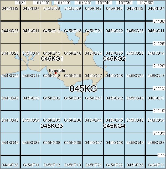
The resolution expressed as the number of digits after the letters: use 0 for a thirty-minute cell, or 1 for a fifteen-minute quadrant, or 2 for a five-minute key area.
Return Value
The GARS string for the GARS square that contains the given LongLat point and has the given resolution.
Remarks
The given longitude must be in the range -999.5° to +999.5°, and the given latitude must be in the range -90.0000001° to +90.0000001°, otherwise the empty string will be returned. A point that is exactly on the border between two GARS squares is interpreted as belonging to the square east or north of the point.
The number of trailing digits must be 0, 1 or 2; other values will throw an exception.
 |
Examples: if we define Honolulu = Point(-157.858, 21.307), then
FormatGars(Honolulu, 0) should return "045KG",
FormatGars(Honolulu, 1) should return "045KG1", and
FormatGars(Honolulu, 2) should return "045KG18".
Platforms
Windows, Linux, Android